Walking Magma Geopark

Raghu Yadav
| 03-11-2026
 · Travel team
In southwest Norway, Magma UNESCO Global Geopark reveals a landscape shaped by ancient geological forces and powerful glaciers. Pale rock surfaces, enormous boulder fields, clear lakes, and rugged coastal hills make this an unusual destination for walkers who enjoy discovering the stories hidden beneath the ground.
Stretching across several municipalities in Rogaland and Agder, the geopark is a region rather than a single attraction. Its highlights range from accessible roadside viewpoints to demanding mountain walks, making careful route selection worthwhile. Egersund provides a convenient starting point, while smaller villages offer quieter bases closer to particular trails.
Discover the Ancient Anorthosite
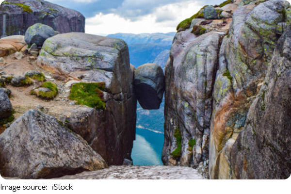
Magma Geopark is best known for its unusual anorthosite bedrock, a pale, crystalline rock that gives parts of the landscape an almost lunar appearance.
The rock formed deep within the Earth's crust approximately 930 million years ago, when molten material cooled and crystallized. Anorthosite is also abundant in the Moon's highlands, which helps explain why the geopark's geology is frequently compared with the lunar surface.
The region's present appearance owes much to later glaciation. Moving ice polished exposed rock, carved valleys, and transported enormous boulders across the landscape.
One of the most interesting places to observe these features is Hellersheia, near Sokndal. This upland area contains extensive anorthosite surfaces, scattered boulders, and small lakes surrounded by rocky terrain.
The walking routes here can be demanding, with uneven ground, exposed sections, and slippery surfaces after rain. Hellersheia is therefore better suited to reasonably experienced walkers than visitors looking for a short paved path.
Take time to examine the rock's pale mineral patterns and the broader arrangement of lakes and ridges. The geological story becomes clearer when viewed both up close and from across the surrounding hills.
Walk the Hellersheia Plateau
Hellersheia offers one of the geopark's most distinctive hiking experiences, combining open rocky terrain with traces of the glaciers that once covered southwest Norway.
The plateau lies in the Sokndal area, south of Egersund, and is characterized by exposed anorthosite, shallow lakes, and large stones left behind by retreating ice.
Unlike a typical forest trail, walking here involves navigating irregular rock surfaces and open terrain. Some sections require careful footing, particularly where the path crosses smooth or sloping bedrock.
The landscape is especially atmospheric on clear days, when pale rock contrasts with dark-blue lakes and surrounding hills. Low clouds can create an entirely different impression, making the plateau feel remote and dramatic.
Plan several hours for a substantial walk, depending on the selected trail and starting point. Exact distances and difficulty depend on the route, so choose a marked itinerary suited to your group's experience.
The exposed terrain offers limited shelter from changing weather. A waterproof jacket, sturdy footwear, and an offline map are valuable even when conditions appear favorable at the beginning of the hike.
For visitors interested in geology, Hellersheia is more than a scenic walk. It provides an opportunity to see how ancient bedrock and much younger glacial processes combined to create the landscape visible today.
Hellersheia
Explore Gloppedalsura
Gloppedalsura is one of southwest Norway's most impressive geological sights, featuring an enormous accumulation of fallen boulders between steep mountain slopes.
Located near Byrkjedal, the boulder field is often described as one of northern Europe's largest rockfall deposits. Its massive stones form a dramatic landscape that can be appreciated without undertaking a strenuous mountain hike.
The site developed through a combination of geological processes associated with the last Ice Age and subsequent rockfalls. Large blocks accumulated in the valley, creating the extraordinary formation visible today.
A road runs through the area, allowing visitors to take in the scenery from designated stopping points. This makes Gloppedalsura particularly attractive to travelers with limited time for walking or mixed mobility needs.
From Egersund, the drive generally takes about 1 hour, depending on the route and road conditions.
The nearby village of Byrkjedal provides a convenient place to pause during a longer journey through the geopark.
Although the roadside views are accessible, climbing among the boulders is not advisable without an appropriate route and experience. Loose stones, steep surfaces, and hidden gaps can make the terrain hazardous.
Gloppedalsura works particularly well as a half-day excursion or as part of a scenic drive through the northern section of Magma Geopark.
Use Egersund as Your Gateway
Egersund is one of the most convenient starting points for exploring Magma Geopark, especially for visitors traveling without a rental car.
The town has a railway station on the Sørlandet Line, with connections toward Stavanger and Kristiansand. Trains from Stavanger generally take around one hour to reach Egersund, making it accessible for a short break from the city.
Egersund itself has an attractive historic center, traditional wooden buildings, and access to coastal walking routes. Spending time here provides a gentler introduction to the region before venturing into more remote geological landscapes.
Local buses operate within the regional transport network, but service to rural trailheads can be limited. A short local journey may cost around NOK 45–60, while longer trips depend on the zones traveled.
For visitors planning several geological stops in one day, a rental car is usually the more flexible option. The geopark's attractions are spread across a large area, and public transport does not connect directly to every trailhead.
A useful approach is to spend the first day exploring Egersund and its surroundings, then reserve a separate day for Hellersheia or Gloppedalsura.
This avoids rushing between distant attractions and leaves more time to appreciate the landscape.
Compare Three Places to Stay
Accommodation choice can make a significant difference when exploring Magma Geopark because its main attractions are spread across several municipalities.
Grand Hotell Egersund is a convenient option for travelers who prefer a central location. Situated in the historic town center, it provides easy access to restaurants, shops, and the railway station.
Double rooms at established hotels in Egersund typically range from NOK 1,500–2,300 per night, depending on travel dates and room category. The town is particularly practical for visitors combining hiking with public transport.
Farther north, Byrkjedalstunet offers accommodation in a rural setting close to Gloppedalsura. Its traditional architecture and surrounding mountain scenery make it appealing for travelers planning a road trip through the northern geopark.
For a coastal alternative, Sogndalstrand Kulturhotell occupies restored historic buildings in the small village of Sogndalstrand, near Sogndal. Its setting is especially attractive for visitors concentrating on the southern part of the geopark.
Sogndalstrand is a quieter base than Egersund, with a distinctive historic atmosphere and convenient access to nearby coastal scenery.
Rural accommodation in this region can range from approximately NOK 1,500 to well above NOK 3,000 per night, particularly for distinctive heritage properties or larger rooms.
Choosing a hotel close to the intended walking area often saves more time than selecting the cheapest room farther away.
Prepare for the Rocky Terrain
Walking in Magma Geopark is rewarding, but the landscape requires more preparation than its relatively modest elevations might suggest.
Exposed anorthosite can become slippery after rain, and some routes cross uneven surfaces without the continuous paths found in more developed hiking destinations.
Sturdy hiking shoes with reliable grip are essential. Carry a waterproof outer layer, drinking water, snacks, and a downloaded trail map, particularly when exploring remote plateau areas.
The most comfortable hiking season generally extends from late spring through early autumn. May to September usually offers longer daylight hours and more favorable walking conditions, although rain and strong winds remain possible throughout the year.
Summer temperatures in the coastal lowlands are often mild, commonly around 15–20°C during the day. Conditions can feel considerably cooler on exposed hills, especially in windy weather.
Visitors seeking easier experiences can combine a short walk near Egersund with roadside viewpoints at Gloppedalsura. More experienced hikers may prefer spending a full day exploring Hellersheia.
Magma Geopark's geological attractions are generally spread across publicly accessible landscapes rather than a single ticketed park. Many outdoor locations can be visited without an admission fee, although parking, guided activities, and individual attractions may have separate charges.
Respect marked routes, avoid unstable rock formations, and leave geological features undisturbed so the landscape remains intact for future visitors.
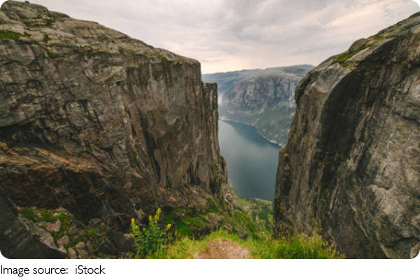
Magma Geopark reveals an extraordinary side of southwest Norway, where ancient anorthosite bedrock meets landscapes transformed by glaciers. Hellersheia offers challenging walks across pale rocky plateaus, while Gloppedalsura provides dramatic scenery with minimal hiking required. Egersund serves as a practical transport hub, and the quieter surroundings of Byrkjedal and Sogndalstrand suit travelers exploring specific parts of the region. Allow at least two days to appreciate the geology without rushing between distant locations.